Five Leisurely Trail Walks in NC’s Yadkin Valley
Not far from the Blue Ridge Parkway in Surry County, North Carolina, outdoor adventure can be rewarding without being strenuous. Here’s the scoop on five must-see Yadkin Valley trails where the walking is easy ...
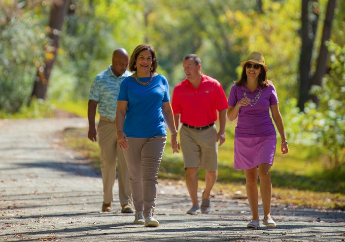
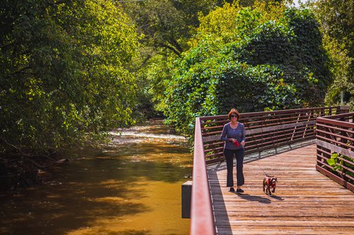
The Elkin & Alleghany Railroad Trail begins in Elkin Municipal Park and follows an old railroad route along Big Elkin Creek. The wide, level trail has a crushed-gravel surface. The route is two miles (four miles round trip) and crosses seven bridges, including a 75-foot wooden bridge.
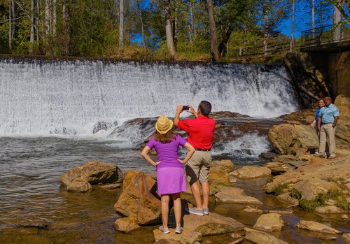
The spillway waterfall on Big Elkin Creek is a nice place to stop for photos. For those interested in a little extra adventure, there are steps down to the rocks below the dam. Click here to learn more about the Elkin & Alleghany Railroad Trail.
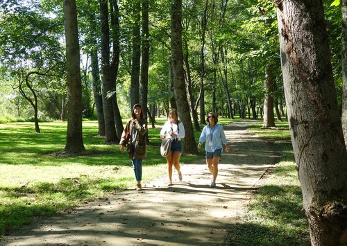
The mostly shaded Loop Trail at Fisher River Park in Dobson is a 1.5-mile greenway, with an additional 0.75 mile of connectors. Enjoy a relaxing, meandering walk along the riverside and throughout the main section of the park on level, crushed-rock pathways. A walking map of Fisher River Park is available here.
Fisher River Park also has a 6.5-mile section of more adventurous multi-purpose trails for hiking and mountain biking.
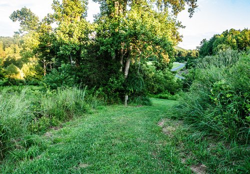
Located down a one-lane country road is Pilot Creek Meadow Walk, part of Pilot Mountain State Park. Walkers often see birds, butterflies and dragonflies while following the mowed trail above Pilot Creek. The path is part of the Rosalynn Carter Butterfly Trail and was established to benefit native pollinators and grassland birds.
Insider tip: Pilot Creek Meadow Walk is not on the official park map yet. It's located off Boyd Nelson Road and can be accessed from the parking area for the Pilot Creek Trail. The meadow is just north of that - look for a red gate that you can walk through.
Photo courtesy of ExplorationSolo.com. More info about this trail (and nearby Pilot Mountain trails) is available at this article by ExplorationSolo.com.
The 6.6-mile Granite City Greenway forms a horseshoe around Mount Airy. The east trailhead begins at Riverside Park and follows the Ararat River until curving westward along Lovills Creek. The wide, paved greenway is ideal for walking, jogging, cycling and trout fishing.
Learn more about the Granite City Greenway by reading this great article.
At the popular Cumberland Knob overlook on the Blue Ridge Parkway, the Cumberland Knob Trail provides an easy half-mile walk through a picnic area and along a meadow to the overlook shelter. It's an easy stroll, slightly uphill on the way out and reversing to slightly downhill on the way back.
At the overlook shelter are photo-worthy views of the 2,885-foot peak of Cumberland Knob. Interesting fact: Construction of the 469-mile Blue Ridge Parkway began at Cumberland Knob on Sept. 11, 1935. There's a kiosk with information, including an article about the start of construction from the Mt. Airy News.
Click here for more info about this trail.
Related News
-
 Jun 7, 2019
Wake up to Vineyard Views at Numerous Yadkin Valley Wineries
A perk of visiting Yadkin Valley wine country is staying in the vineyards. Several wineries along the Surry County Wine Trail offer lodging on property. Whether you’re looking for a romantic hideaway for two or a larger option for a group, there’s a spot for you. -
 Jun 19, 2017
Enjoy Music in the Vineyards at Shelton's Sunset Concert Series
Spend a pleasant Saturday evening at Shelton Vineyards' outdoor amphitheater listening to live music, dancing and sipping award-winning wine. -
 Jan 1, 2019
Four Great Places for a Destination Wedding in Yadkin Valley
The rolling hills of Surry County in North Carolina's Yadkin Valley wine country create a beautiful setting to say, “I do.” -
 May 8, 2021
Celebrate NC Wine Month in Yadkin Valley
Celebrate North Carolina Wine Month along the Surry County Wine Trail in the Yadkin Valley American Viticultural Area. Enjoy featured wines and more throughout May.